Mapping a course
City Council approves Comprehensive Plan, Future Land Use Map
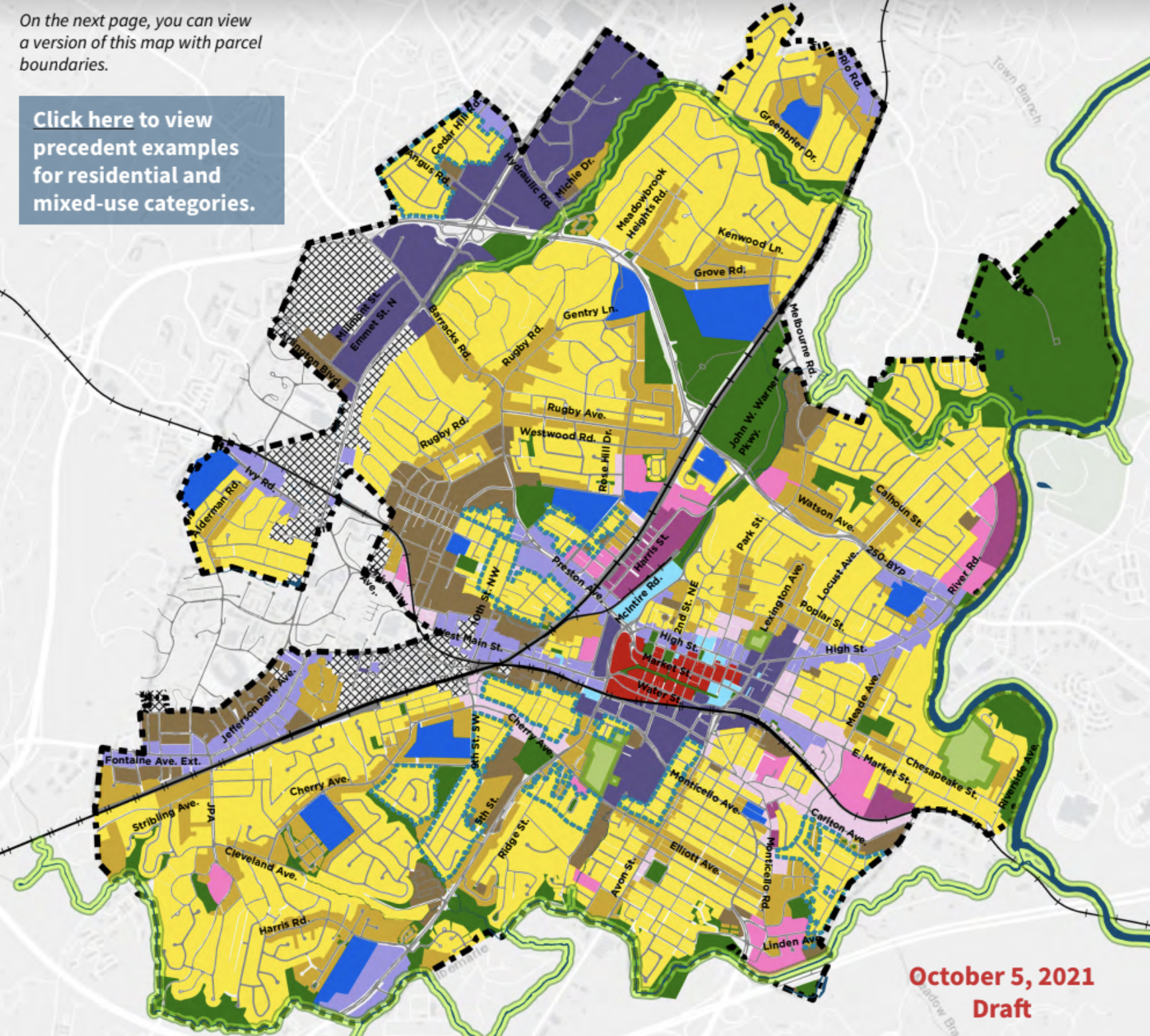
The mustard-colored areas in the Future Land Use Map are designated medium-intensity residential, meaning this is where the city might be able to support increased density. Concern from some citizens and councilors over the inclusion medium-intensity residential wasn’t enough to delay the passage of the Comprehensive Plan. Photo: City of Charlottesville

Support C-VILLE Weekly
C-VILLE Weekly is Charlottesville’s leading newspaper. Founded in 1989, it’s been the area’s local source for informative (and informed) stories in news, arts, and living for more than 26 years.
UP NEXT
The Big Picture
Charlottesville Design Week
Price of prevention
The B.U.C.K. Squad is frustrated with final VCF allocation
Green speak
Post columnist talks nature at the Jefferson School
In brief
Council approves budget, and more
IN CASE YOU MISSED IT
The Big Picture
Charlottesville Design Week
Price of prevention
The B.U.C.K. Squad is frustrated with final VCF allocation
Green speak
Post columnist talks nature at the Jefferson School
In brief
Council approves budget, and more
PUBLICATIONS
C-VILLE Weekly | April 17, 2024
C-VILLE Weekly | April 10, 2024
C-VILLE Weekly | April 3, 2024
C-VILLE Weekly | March 27, 2024
Real Estate Weekly | April 17, 2024
Real Estate Weekly | April 10, 2024
Real Estate Weekly | April 3, 2024
Real Estate Weekly | March 27, 2024
Knife & Fork | Spring/Summer 2024
Fine Properties | Spring 2024
Abode | Winter 2024
Weddings | Fall/Winter 2023
Best of C-VILLE 2023
We Are C-VILLE | March 2024
Summer Camp Guide | March 2024
National Nonprofit Day | August